
Walk a Wheeling Street Record
A good Wheeling street directory search moves from place to record, not from a loose name to a guessed home. Start with the full street number, direction, street name, unit, postal city, and ZIP. Keep the postal label separate from the Village name. Then use a parcel map to identify the county, township, parcel key, and legal description. Those facts select the right assessor and recording office. The owner shown on an assessment card is not automatically the occupant. A deed names parties to a transfer, while a historic phone book names a subscriber. Each source answers a narrower question.
- Verify the exact mailing form with USPS. Preserve any postal city that differs from Wheeling.
- Open the Village Community Map Viewer, select the parcel, and record its PIN or PARID, county, and map date.
- Search the matching Cook or Lake assessment system. Compare the situs, or property location, with any separate billing address.
- Carry the parcel key into the county recording index. Follow deed references and legal descriptions rather than relying only on street text.
- For an older household, ask the library or Historical Society for a named directory year and a page citation.
This order catches the most common Wheeling error: searching Cook records for a Lake-side parcel, or the reverse. It also creates a clear audit trail. Save the wording and date from each result. If two systems disagree, the county map and recorded legal description deserve more weight than a postal label.
Search Wheeling Addresses in Cook
The Cook County Assessor address search has rules that matter. Enter the street name without a type such as Ave, St, or Pl. A house number and street name are required, while direction, unit, and city can narrow the result. The site also accepts a full PIN. For a street directory search, record the returned PIN and then compare the parcel in CookViewer. Do not treat the first similar address as a match.
| Cook field | Use | Format note |
|---|---|---|
| House Number | Required address anchor | Enter the street number only |
| Direction | Separates similar streets | N, S, E, W, NE, or NW |
| Unit Number | Narrows a unit record | Optional and not present in every deed index |
| Street Name | Required street key | Omit Ave, St, and Pl |
| City | Optional location filter | Check against the returned municipality |
| PIN | Direct parcel search | Fourteen digits on the main form |
The property detail may show township, class, assessed land and building values, and a property-location warning. Assessment data describes a parcel and taxpayer relationship. It does not list all occupants.
The sample Wheeling parcel detail shows how Cook presents a street result.
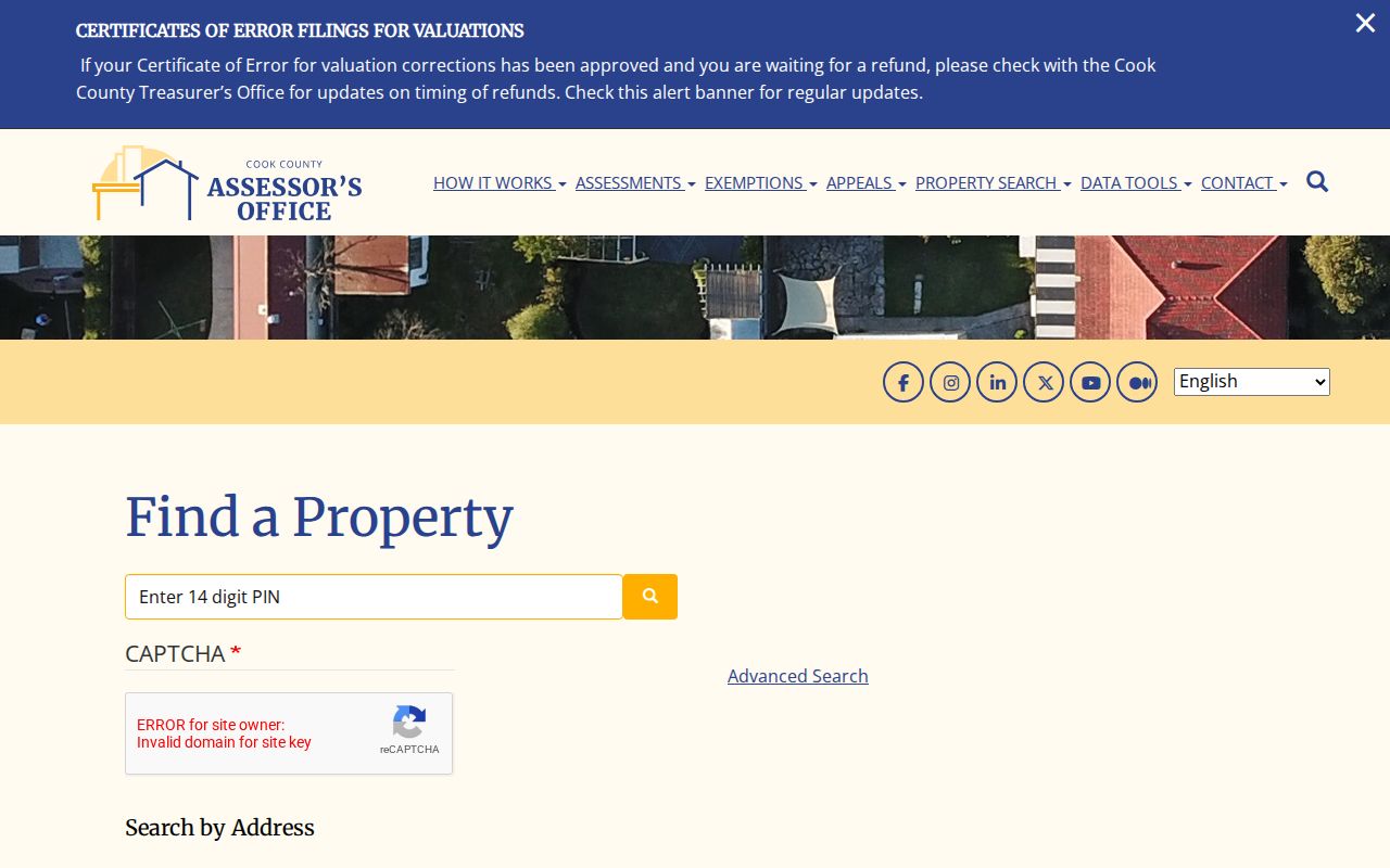
The captured form makes the direction, unit, and street-name rules visible before a search is submitted.
Split Wheeling Streets by County
Wheeling is incorporated in both Cook and Lake Counties. Assessment is performed through Wheeling Township, while taxes, recorded deeds, and many other records follow the county of the parcel. A Wheeling mailing label alone cannot choose the custodian. The Village GIS is the shared starting point, followed by CookViewer or the Lake Tax Parcel Viewer. If one county returns no result, recheck the municipal map before declaring that the address is missing.
Road ownership is a second split. The Village identifies Dundee, Elmhurst, Milwaukee, McHenry, Palatine, and Wolf as state roads. Lake-Cook, Schoenbeck, Hintz, Camp McDonald, Buffalo Grove, Old Buffalo Grove, and Aptakisic appear as county-maintained roads. A request for paving, signs, or traffic work belongs with the road agency, while a permit, zoning, or Village map request can go through the Village Clerk or Community Development. This custody check saves a failed public-record request.
Wheeling Records Indexed by Address
Address-keyed sources overlap, but they are not interchangeable. The table shows what each Wheeling street search can support and where a failed online search should go next.
| Record Set | Keeper | What It Shows | Access |
|---|---|---|---|
| Assessment record | Cook Assessor or Lake assessment office | Parcel, class, values, public owner or billing fields | Online, then office help |
| Parcel map | Village, Cook, or Lake GIS | Parcel boundary, PIN, districts, nearby roads | Free viewer or public terminal |
| Recorded instruments | Cook or Lake County Clerk | Deed parties, dates, document number, legal description | Online index; copies or older files through Clerk |
| Voter verification | Illinois and county election offices | Registration and polling workflow for the person submitting required facts | Official form or county office |
| Permit and zoning files | Wheeling Community Development | Public project and administrative history by address | Department or Village FOIA request |
The parcel key is the strongest bridge. It connects the map to assessment and deed records even when a street spelling changes. For permits, no unrestricted Wheeling permit-by-address index was located. Ask Community Development for the specific address, record type, and date range. Illinois voter verification requires personal facts and is not an open street list, so it cannot be used to publish names block by block.
Browse Wheeling Streets in CookViewer
CookViewer searches by address, intersection, parcel, or PIN. A result can expose township, municipality, zoning, parcel class, land size, district layers, assessed values, and links to Clerk and assessor records. Address results may include several parcels within about one hundred feet, so click the exact map feature. The nearby tool can compare a selected parcel within set radii up to one mile, but physical proximity does not establish a shared household or personal relationship.
The viewer also offers parcel history from 2000 forward and aerial imagery reaching back about 1998. Those layers show change in roads or parcel shapes. They do not replace a deed chain. Export only the few parcels needed for a defined question, and retain the map date with any saved result.
The official CookViewer screen below shows the parcel and nearby context used in a Wheeling street directory search.
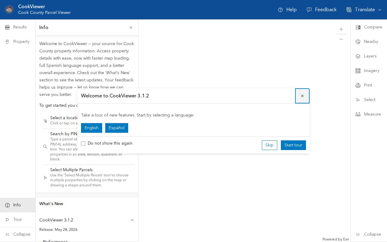
The map helps distinguish adjacent parcels before names or recorded instruments are compared.
Follow Wheeling Deeds by Street
After confirming the county and PIN, search the Cook County Clerk Recordings System or the Lake County official-records search. Cook supports property, address/PIN, full, and advanced searches. Lake offers quick and advanced routes with party, date, document, subdivision, and OCR options. A grantor is the party transferring an interest; a grantee receives it. A recorded party may never have lived at the site.
For a backward chain, open the newest deed and note its prior-document reference, legal description, subdivision, lot, and recording date. Repeat with the earlier instrument. Cook online index coverage is strongest from 1985 forward. Older or unscanned material may require the Clerk, microfilm, or vault records. The index is a finding aid; an official copy comes from the custodian.
The Cook search image comes from the Clerk's live recording portal.
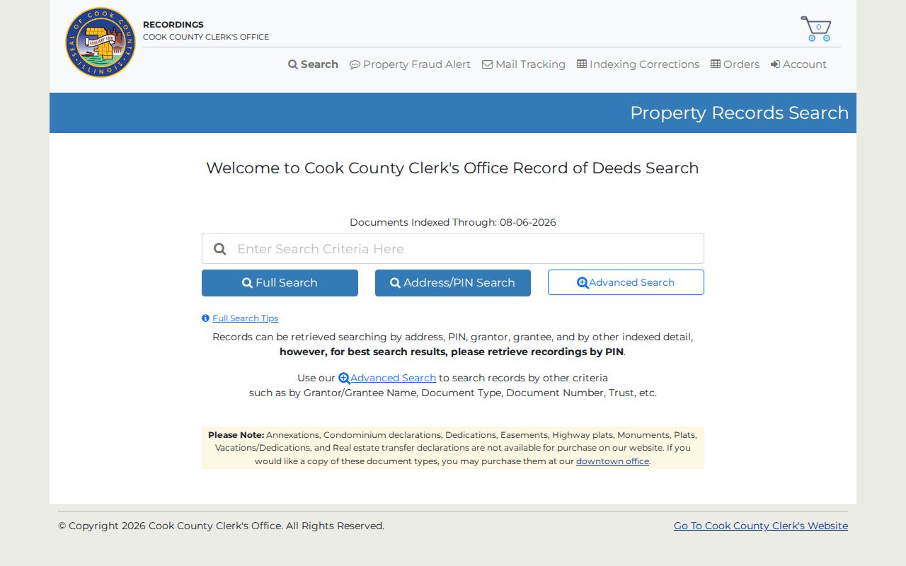
Its address and PIN routes show why the parcel key should be saved before tracing transfers.
Check Lake-Side Wheeling Addresses
The Lake County property search accepts parcel, owner, billing name, property address, unit, and ZIP fields. ZIP is a filter, not proof that a parcel sits in Wheeling or Lake County. Confirm the PARID and map position in the Lake parcel viewer. The map carries a non-survey disclaimer, so use it to locate a parcel and then rely on county records for legal facts.
Lake's form is useful when the same road nears the county line or a Cook query fails. Keep property address and billing address in separate notes. Then use the PARID, subdivision, or legal description in the Lake recording system.
The official Lake property form below is the Lake-side source for a by-address search.
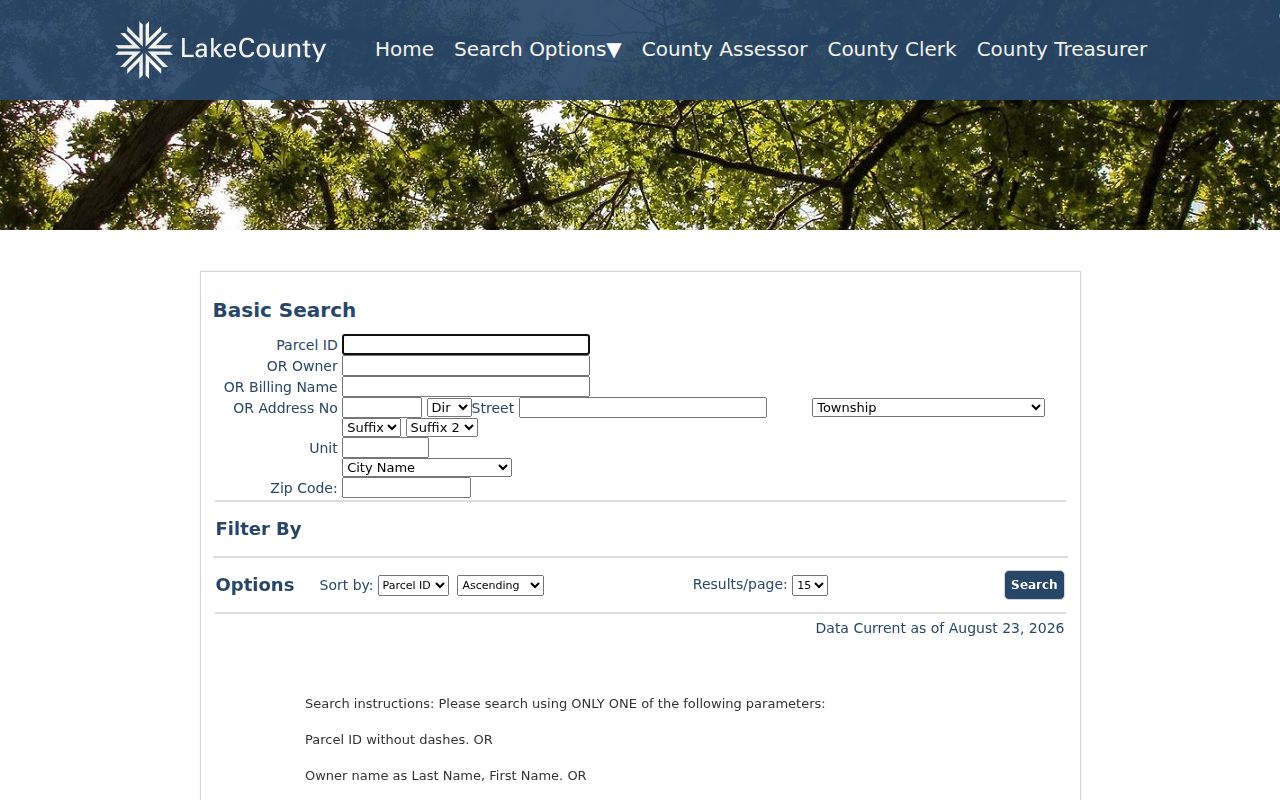
The ZIP and unit fields can narrow a result, while the returned parcel remains the key to verification.
Decode Wheeling Street Terms
County systems use several terms for the same place from different legal or tax viewpoints. Define them before comparing results.
- Parcel
- A mapped unit of land tied to a county identifier and assessment record.
- Situs address
- The property-location address, which may differ from a billing or postal address.
- Plat
- A recorded map of a subdivision, lots, blocks, easements, or other land divisions.
- Criss-cross directory
- A directory arranged by street and house number rather than only by surname.
A PIN can change after a split or consolidation, and a legal description may outlast a street form. Historic maps and directories must also be read for their own date. Never modernize an old street label without keeping the printed version in the citation.
Place Wheeling Streets in Time
Modern parcel records do not answer an early household question. The Wheeling Historical Society names 1909 and 1925 telephone directories, 1927-1928 and 1966 information directories, historic maps, newspapers, and business-address files. Indian Trails library's dated holdings survey also lists Haines directories, city directories, phone books, plat maps, and Wheeling Township maps. Ask staff to confirm that a year is still held and whether it includes a street-order index.
The historical shelf belongs in depth on the Wheeling city directories page. For a street search, record only the exact printed address, name, directory year, page, and collection. Then compare it with a dated plat or map and the county deed chain. A telephone subscriber is a useful address lead, not proof of title or every person in the home.
Request Missing Wheeling Street Records
Online tools are only one access channel. Village Hall, county recording and assessment offices, public GIS terminals, Indian Trails Public Library, and the Wheeling Historical Society can handle focused questions. Bring the exact address, parcel key, county, date range, and record category. For a Village permit, map, ordinance, meeting, or street file, use the Wheeling FOIA route. Illinois FOIA does not make private library holdings or restricted personal files public.
Mail, phone, and in-person requests work best when narrow. Name the road segment or parcel and ask for inspection or copies. For an IDOT or county road, contact that road owner. For an old directory, request the exact volume and page citation from the library or Society. These fallbacks preserve a street directory trail when a portal fails.
Limits of Wheeling Street Records
No official Wheeling street directory supplies a complete current household roster. Assessment and deed records center on land and transactions. A phone directory may omit unlisted numbers and names only a subscriber. Voter tools and files are controlled by election law. Driver-address information is restricted, utility accounts are not a public resident list, and confidential or sealed records remain unavailable. A missing name can mean that the source does not index that role, not that the person has no connection to Wheeling.
Report each finding in source language: owner, taxpayer, grantor, grantee, subscriber, applicant, or named party. Add the record date and county. Do not collapse those roles into "resident." When current contact is the goal, use consent or a direct public contact route instead of exposing private details.
Lawful use. Wheeling address records support family, property, and civic research. Never use them to stalk, harass, threaten, or expose a protected address.